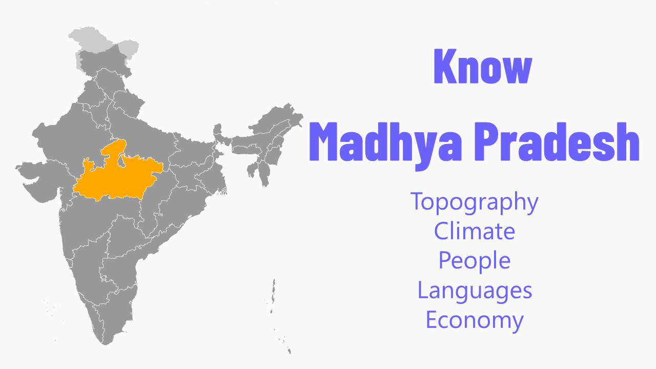


Madhya Pradesh
Topography
Madhya Pradesh, with an area of 3, 08, 000 sq.km. is the second largest state in India after Rajasthan. It is a part of peninsular plateau of India lying in north central part, whose boundary can be classified in the north by the plains of Ganga-Yamuna, in the west by the Aravali, east by the Chhattisgarh plain and in the south by the Tapti valley and the plateau of Maharashtra. The topography of Madhya Pradesh is defined by the Narmada Sone Valley. It is a narrow and long valley extending through almost the whole of the state from east to west. Sone valley forms the upper part; Shahdol and Sidhi districts lie in this valley. The lower part forms the Narmada valley. It has an average elevation of 300 m above MSL and is covered with alluvial soil. Jabalpur, Mandla, Narsinghpur, Hoshangabad, Raisen, Khandwa, Khargone and Barwani districts lie in this region. The Sone valley is narrower than Narmada valley and alluvial deposit is also comparatively poor and thin, therefore Narmada valley is more important than Sone valley for agricultural activities. To the north of this valley lie the Central Highlands, to the south the Satpura-Maikal ranges and to the south-east, the eastern plateau. These three form the natural physiographic regions-into which the state is divided. The Central Highlands are spread between the Narmada-Sone valley and the Aravali ranges to the west in a triangular form. The highlands slope towards the north and drain into the Yamuna. The central highlands region in the state includes the following four uplands: The Rewa-Panna plateau is one, also known as the Vindhyan plateau, lies in the north- eastern part of the central highlands. The main rivers flowing in the area are Ken, Sonar, Barna and Tons. Rewa, Panna, Satna, Damoh and Sagar districts lie in this region.The other is Bundelkhand plateau located to the north-west of the Rewa-Panna plateau. Datia, Chhatarpur, Panna, Tikamgarh and parts of Guna and Shivpuri districts forming the northern part of the state lie in this region. The plateau is bounded in north-east by Vindhyan escarp lands or Rewa-Panna plateau. The average height of the region is 350-450 m above MSL and general slope is towards north. The main rivers flowing in the area are Betwa, Dhasan and Jamner which finally join Yamuna. Central India plateau is the third that lies to west of Bundelkhand plateau. Shivpuri, Morena and Gwalior districts exist in this region. This plateau has an average elevation of 450 m on highlands and 150-450 m above MSL in valleys. Chambal, Kali Sindh and Parvati are the main rivers flowing in this area. The fourth Malwa plateau covers almost the entire western Madhya Pradesh. The plateau is bounded in the north by Chambal and in south by the Narmada. The average elevation ranges between 300-500 m above MSL. Shajapur, Dewas, Indore, Ujjain, Dhar, Ratlam and parts of Sehore and Jhabua districts lie in this region. Bhopal is situated at the eastern edge of the Malwa plateau. Shipra, Parvati, Kali Sindh, Gambhir and Chambal rivers flow through the Malwa plateau. It also forms the water divide between the Ganga and the Narmada basin. The soil in the area is black cotton as a result of weathering of basalts.
Satpura-Maikal ranges lie to the south and the eastern plateau regions to the north- east of the Narmada - Sone valley. Chhindwara, Betul, Seoni, Balaghat, Mandla and parts of Khandwa and Khargone districts lie in the Satpura-Maikal ranges. Average height of these ranges is 300 m ; but there are several high peaks; the highest peak of the state, Dhoopgarh that rises to 1360 m above msl lies in these ranges. The slope is sharp in south face and gentle on northern side. The eastern part, the Satpuras, is wider than the western part which stretches in the form of a semi-circle and is known as the Maikal ranges. The Maikal ranges include the Amarkantak plateau, which is origin of both Narmada and Sone rivers. The other rivers in the area are Johila, Macherwa, Denwa and Choti Tawa which join the Narmada. The eastern plateau region comprises Baghelkhand Plateau lying between Maikal ranges and Chhattisgarh plain area with an elevation of 1033 m above MSL.
Climate
Like other parts of India, Madhya Pradesh also has three major seasons - Summer Monsoon and Winter. During summer (March-June), the temperature in the entire state ranges above 29.4°C. In general, the eastern parts of Madhya Pradesh are hotter than the western parts. The regions like Gwalior, Morena and Datia record temperature of over 42°C in the month of May. The humidity is relatively very low and the region usually experiences frequent mild dust storms. The south-west Monsoon usually breaks out in mid June and the entire state receive a major share of its rainfall between June and September. The south and south-east regions tend to experience a higher rainfall whereas the parts of north-west receive less. Mandla, Balaghat, Sidhi, Jabalpur and other extreme eastern parts receive more than 150 cm rainfall. The districts of western Madhya Pradesh receive less than 80 cm rainfall.
The winter season starts from the month of November. The temperature remains low in the northern parts of the state in comparison to the southern parts. The daily maximum temperature in most of the northern part in the month of January remains between 15 and 18°C. The climate is generally dry and pleasant with a clear sky.
People
The population of Madhya Pradesh is over 7 crore. More than 75% of the population resides in villages whose main occupation is agriculture, while the rest of the population lives in towns. The majority population is Hindu with Muslims making up the largest minority community. The tribes of Madhya Pradesh constitute over 20 % of the state's population and are mainly concentrated in southern southwestern and eastern parts of the state. The social customs prevalent among different tribes and castes vary more due to variation in their habitat and surrounding geographical conditions. For earnings they depend upon agriculture, forest produce and local craft. With improved communication and growth in the economy, the tribal's way of living is changing.
Baigas believe themselves to be descendents of Dravid and this tribe is found in Mandla, Balaghat, Shahdol and Sidhi districts. Saharia inhabit north-west area mainly in the districts of Gwalior, Shivpuri, Bhind, Morena, Sheopur, Vidisha and Raisen. Most Saharias are cultivators. Bharia tribe has major concentration in Jabalpur and Chhindwara districts of Madhya Pradesh. The place Patalkot in Chhindwara has almost 90% population of Bharias. They work as agriculture labourers and work upon bamboo to create beautiful baskets and other items.
Gond is the best known tribe and forms the largest group in Madhya Pradesh. They mainly inhabit areas on both sides of Narmada in Mandla, Chhindwara, Betul and Seoni regions and the hilly terrains of Vindhya and Satpura regions. Agaria, Pradhan, Ojhan, Solahas are the descendant tribal groups originating from Gonds, with two sub-castes - Rajgond and Datoliya.
Bhil, the second largest tribe, is largely concentrated in areas around Jhabua, Khargone, Dhar and Ratlam. They are regarded as warrior with fine inherited guerrilla tactics and archery skills. Korku tribal community is administered by the head of a panchayat called Sarpanch and they are found in Hoshangabad, Betul, Chhindwara, Harda and Khandwa districts of Madhya Pradesh. Santia is a tribe of Malwa, who believe themselves to be originally a martial Rajput tribe. They prefer to remain nomadic. Mainly of labour class, Kols are found in Rewa, Sidhi, Satna, Shahdol and Jabalpur districts. This caste finds mention even in ancient puranas and the famous epics of Ramayana and Mahabharata and they are highly religious minded and staunch believer of Hindu mythology. Lesser known tribes like Dhanuk, Panika, Saur still form an important group.
Languages
Hindi, the official language of Madhya Pradesh, is the most widely spoken and easily understood even in remote corners of the state. For a large number of people in the major towns and cities and for the business class English is the second language. It is widely spoken by those engaged in the hospitality and service industry. One would see words of English and Hindi both used on signages, milestones, shops and offices signboards. Malwi, Bundeli, Bagheli, Nimari are the commonly spoken regional dialects. There are several dialects which are spoken.
Economy
Madhya Pradesh, India's second largest state, which occupies 9.38% of the country's area, is also the second richest state in terms of its mineral resources. Primarily, it has an agricultural and pastoral economy. Industrial development is primarily concentrated in the more advance districts like Indore, Bhopal, Gwalior and Jabalpur.
A large part of the mineral production of India is contributed by Madhya Pradesh. Big reserves of Manganese are found in Balaghat and Chhindwara districts. The state also produces about 45% of Bauxite in India with Jabalpur, Mandla, Shahdol, Satna and Rewa being the important Bauxite producing centers. Iron ore deposits are found in Balaghat, Jabalpur and Mandla districts. The State of Madhya Pradesh also has rich reserves of coal in the northeastern and Satpura regions. The state has the distinction of being the only diamonds producing state in India, with production in Panna and Chhatishgarh districts.
Over 30% of the State's total area is enveloped by the forest. The eastern districts of Balaghat, Mandla, Shahdol, Sidhi have dense forest cover. The abundantly found trees include Teak, Sal, Bamboo and Tendu. Agriculture is the main occupation of villagers, Wheat, Soybean and Jowar (Sorghum) are the main Crops. Paddy and Coarse Millets are also sown in large parts. Pulses, Cereals and Groundnut are also grown. Important among the cash crops are Cotton, Sugarcane and Oil Seeds. Mandsaur is the largest opium producing district in the country.
The irrigation of land is mostly dependent on major rivers like Narmada, Chambal, Tapti, Betwa, Sone, Shipra, Kali Sindh and Tava. The Chambal valley and the Narmada valley offer good potential for hydroelectric power generation. Besides Thermal and Hydro power generation, numerous other conventional and non-conventional power projects are in place or in the stages of progress. Road density is increasing continuously with present road length being over 80 thousand kms. Communications are well developed.
Rail route connecting different parts of India passes through Madhya Pradesh. Major airports link all major cities like Delhi, Mumbai, Varanasi, Nagpur, Bengaluru, Hyderabad, Chennai etc. Telephone and cellular service provider BSNL and other private operators are operational; internet access is easy across the state. The big industries are mostly in districts of Indore, Bhopal, Gwalior and Jabalpur. Cement, sugar, paper, textile, steel, soya, vehicles and medicine are the major industries today. BHEL in Bhopal, Government Ordnance Factory Jabalpur, Currency Printing Press at Dewas, Alkaloid Factory at Neemuch, Rail Coach Factory Bhopal are notable Central Government managed organisations. Mineral development, industries based on agricultural and forest produce continue to be the mainstay of industrial production in the state.
Madhya Pradesh has enormous potential and resources to become a major tourism destination. Numerous monuments of historical, archaeological, architectural and pilgrimage importance dot the state. The forests are teeming with all kinds of wildlife. Because of its central location and easy accessibility, tourism is becoming a major attraction.